

Handsome Transom
Active Member
- Jan 26, 2018
- 563
- Boat Info
- 1989 SeaRay Sundancer 268 454 Bravo
- Engines
- 454 Mercruiser bravo drive
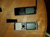
If you ever do replace I am a local buyer for some if your dated gear as mine is better described as ancient lol, ,It still works mind you and that combined with budgetary concerns has kept me out of the market from buying a combined chatplotter fishfinder this year. . I did get a free tablet from Roger's this year and will put navionics pro on it for preplanning and backup. Here's a shot of my current backupsWell, I dont’ run in the ocean, but we do get fog at times and I do run in early AM and at night periodically and I have radar. So until they can overlay radar on my iPAD, i will use the raymarine.
The new raymarine’s have the ability to link your navionics and other data on mobile devices using WIFI I think. It is really cool and truly integrates the two devices. But would mean a complete replacement of my current fully functional, if somewhat dated mfd, sonar unit, fluxgate compass and radome. So will have to wait.
Attachments
Last edited:
")
