The Lake Champlain Thread...

Thanks guys. I'll check with Rob. Like I said I had to work :smt089 but my wife stopped over. She said she tried to help out and at one time was cooking the burgers but I think her major job was making sure Rob didn't have to much beer left over.
 
So I'm thinking of heading back up to The Lake this weekend. It looks like I'll be locking through on Saturday and heading up through the narrows on Sunday, although it's not my preference to be traveling on the weekend. Can any of you lake dwellers give me a beat on weekend canal and lake traffic this summer? I'm guessing the canal will be fine but wondering if I should push my narrows trip 'till Monday. I got spoiled last year by having it to myself on weekdays.
 
Traffic is very light on the lake from what I've seen. I expect the canal would be the same. There's always a bunch of bass fishermen from Crown Point to Whitehall.

Lots of debris in the lake I hear. Just like spring so keep a sharp watch. Nothing like a submerged two foot diameter oak tree to make things a bit sporty...

How far North are you comming this time? How long are you staying? If you make it to Burlington by Sunday the Lake Champlain Maritime Festival is going on. http://www.lcmfestival.com/

We are headed out Friday heading up around Treadwell Bay and beyond.


Frank
 
Last edited:
(Shhhh about the weather)

I'm hoping to make it to Mallet's or perhaps beyond this time (Is The Moorings the best marina to stay at in Mallet's Bay?). I won't be in Burlington 'till Monday or Tuesday. I'm not happy to hear about the debris - that's what I was hoping to escape by leaving The Hudson!

If the weather keeps me from leaving tomorrow I may have to scrap the whole deal, but it's going to be beautiful despite the forecast!!

I wish I could help you but I never go south of the Georgia shore. I was planning a trip to Burlington this "summer" but no luck so far.
 
The Moorings should be good. Champlain Marina should be good as well.

We will be up in Pakmule's territory for the weekend but should be back in the Burlington area by the time you get here.

Pakmule: You going to be out this weekend?


Frank
 
The Moorings should be good. Champlain Marina should be good as well.

We will be up in Pakmule's territory for the weekend but should be back in the Burlington area by the time you get here.

Pakmule: You going to be out this weekend?


Frank

I am going to suggest to the wife that we go over to Burtons for the weekend. I will PM you my cell phone.
 
What a freaking night! After weeks of constant rain we had an absolutely beautiful night on the lake. Four of us went out, dropped anchor, ate takeout sushi and watched the sun go down. Went home at 5 mph and just enjoyed the night.
 
re: Tonite on the lake, you dawg u... I was at Breakwaters, wishing I'd gone out on the lake! It was a gorgeous night, Finally!

I might see you guys, I'll be out this weekend on the Inland Sea, in the Savage to Butler Island/North Hero Areas. Not sure what we're doing on Sunday, it's the gf's b'day, and she said she wants to get out on the boat. Saturday she has to work, so I might go out on my own for a bit if the weather (and work) hold off.

-VtSeaRay
 
Wow, what a wknd. launched in Mallett's Bay on Sat. we were going to head to Valcour, but we turned around at Stave Island, the waves were just pounding to hard, way to many whitecaps. We could have done it, it would have just been a very uncomfortable ride. Hey, what's that campground like place on the north end of Stave in that little bay? All kinds of folks in there, never even knew it existed (coupld buildings too looked like). We pulled in there and ate lunch, then went back to the bay between Mills Point and Porter Point to relax. Then, we cruised around the rest of the bay, going by the huge number of boats rafted up/anchored at Thayer's beach! My gf told me I've spoiled her by always boating in the Inland Sea, with the waves/wind usually being less.

On Sunday, we went out to Savage Island, there were tons of whitecaps again, and fairly good sized rollers, 3-4'. We hung out there for a bit on the north side of the island out of the wind, then were going to head to Burton around 4:00, since it looked like more of the whitecaps had left, but once we got about halfway there, the waves were picking up again,and we decided to head back, rather than be pounding thru the waves all the way from Burton. So, I turned around, and headed into the waves, and before I could bring my bow up, we hit a couple of 4+' waves and went thru them and my gf and her dtr up front had a couple waves pour maybe 5-10 gals of water on them! My gf laughed, but her dtr was whining! We told her to get over it, it was fun!

I heard on the news this morning, that 12 kayakers were headed to Woods Island, and 4 of them capsized and they had to be rescued.

-VtSeaRay

I was lazy and just went to Burton again. :)

We saw the rescue people go by to save the kayakers. I can't believe they were stupid enough to attempt that trip. My 11,000 pound boat was getting pounded by the waves.

On Sunday we took a short trip down to the Georgia shore to say hi to some friends but ended up not staying very long because of the waves.
 
Those were huge waves! On the way towards Burton, we were doing about 20 mph, and it was fun, cresting over the waves, and crashing into the backside of the next one, but going into them was an entirely different story!
 
Now that the weather has finally straightend up we have been able to get out a bit.

The weekend before last we headed out on Sat to Treadwell Bay. Spent the night on one of the moorings in Deep Bay which is part of the Point Au Roche State Park. Headed out Sun morning to Burton Island to meet up with Pakmule and get a quick tour of Dancing Queen. Beautiful boat for sure. I want one just like her. Thanks again Kurt. On the way to Burton Island we saw what turned out to be the search for a canoeist that was missing near the south end of the Gut. After leaving Burton Island we headed north around North Hero Island and then south through Alburgh passage. We ended up staying just off the north end of Valcor Island. Mon morning brought a steady south wind and 4-5 footers to head home in. Took about 3 hours to get back to Shelburne Bay. You know your having fun when you have green water washing over the deck.

This past Fri we headed to a small beach near the mouth of the Bouquet River. The weather was great and we stayed untill the winds were supposed to pick up Sat night. Sun we stayed close to home and hung out in a little cove in Shelburne bay.


See ya on the water,
Frank
 
I am curious, to get up to New England Powerboat from Burton do you think it is shorter to go through the gut and up the passage between Alburgh and North Hero or to go around the North side of North Hero? I have always gone up the East side of North Hero and around the top.
 
I am curious, to get up to New England Powerboat from Burton do you think it is shorter to go through the gut and up the passage between Alburgh and North Hero or to go around the North side of North Hero? I have always gone up the East side of North Hero and around the top.
On that NOAA chart site, and google Earth, it looks shorter to go over the top of North Hero from Burton, but only by a little bit. To bad, the carry wasn't a bridged area!
 
Last edited:
I am curious, to get up to New England Powerboat from Burton do you think it is shorter to go through the gut and up the passage between Alburgh and North Hero or to go around the North side of North Hero? I have always gone up the East side of North Hero and around the top.

I'll plot it both ways in Offshore Navigator tonight and let ya know.


Frank
 
I started both routes from the green can at the south end of Ball Island since I figured you had to go around it either way. According to Offshore Navigator the Northern route is 13.75 NM and the Southern route is 13.8 NM. I'd say you could go whichever way you cared to.


Frank
 
Last edited:
I started both routes from the green can at the south end of Ball Island since I figured you had to go around it either way. According to Offshore Navigator the Northern route is 13.75 NM and the Southern route is 13.8 NM. I'd say you could go whichever way you cared to.


Frank

Cool, thanks for that. I think the route I have been taking is better as I would probably have to come off plane a lot the other way. If it was a lot shorter it might have made up for it.
 
Kurt,

You can plot this in google earth too.(and probably in the NOAA utility too, but I haven't tried that) http://demo.geogarage.com/noaa/

What a weekend for weather!(and it's continuing until Thurs or so this week...) Where was this during my summer vaca... argh. Yesterday, we went from Georgia shore out thru the gut, and down to Valcour, touring around the island, anchored in the bay on the southwest corner of the island, near Bluff Point for a while, then we went to the Naked Turtle for dinner. There was no problem finding a parking spot on the Plattsburgh city dock, not that many motorboats out on the lake!

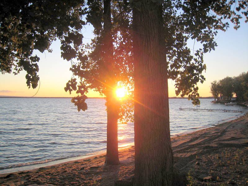
Sunset from my parents house
IMG_4829.jpg


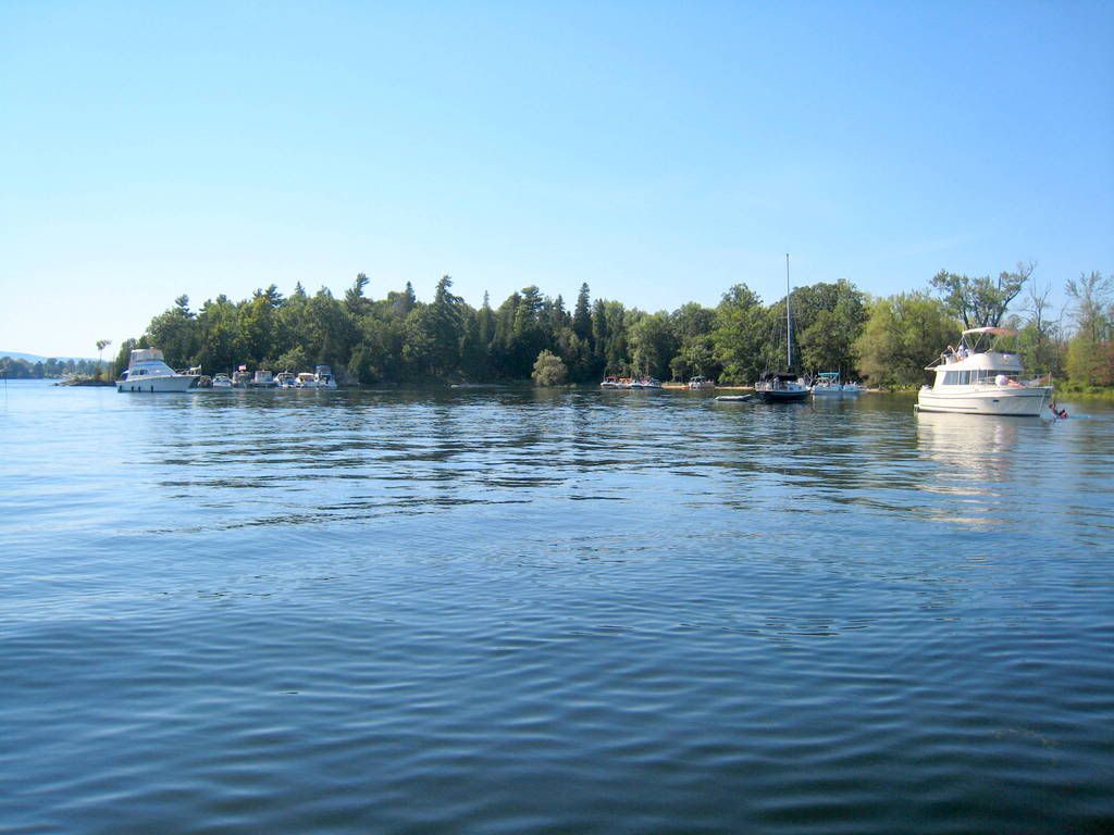
the bay south of Bluff Point off Valcour
IMG_4838.jpg
 

Forum statistics

Threads
113,206
Messages
1,428,571
Members
61,109
Latest member
Minnervos
Back
Top